
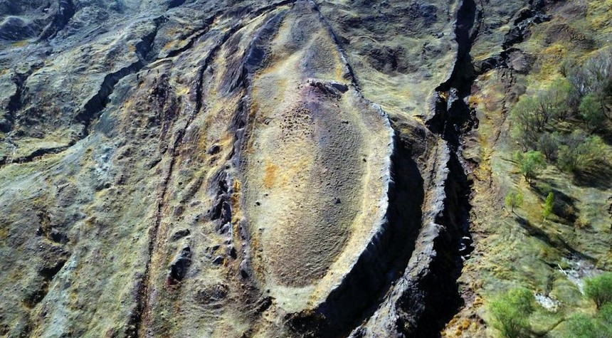
An international team of researchers has announced findings that they believe may resolve one of archaeology’s most enduring questions: the location of Noah’s Ark as described in the Book of Genesis.
The team, operating under the name Noah’s Ark Scans, has conducted extensive ground-penetrating radar surveys and deep-core drilling operations at the Durupınar Formation in eastern Turkey, approximately 18 miles south of Mount Ararat. Their findings, they assert, point unmistakably to a man-made structure buried beneath the boat-shaped geological formation that has puzzled scientists and Biblical scholars for generations.
The investigation represents nearly three decades of work by project founder Andrew Jones, an independent researcher who has dedicated much of his professional life to this pursuit. Jones acknowledges that radar technology has its limitations, but maintains that the structural patterns revealed by their most recent survey work constitute compelling evidence of human construction beneath layers of accumulated sediment and earth.
The research team employed ground-penetrating radar technology originally developed for United States Air Force applications. This sophisticated equipment identified what the team describes as massive underground chambers, hollow spaces, and precisely aligned linear walls suggesting ancient rooms and corridors. Most notably, the scans revealed what appears to be a tunnel network extending 151 feet in length.
Of particular interest to those familiar with the Genesis account is a distinct 20-foot-thick band located approximately 16 feet below the surface. This band appears to separate into three discrete layers, which researchers note corresponds to the Biblical description of the Ark’s construction: lower, second, and third decks as specified in God’s instructions to Noah.
Jones emphasized a crucial finding that challenges long-standing geological explanations for the formation. The team’s drilling operations encountered neither bedrock nor solid limestone, contradicting theories that have attributed the boat-shaped mound to natural forces such as ancient glacial activity or prehistoric mudslides.
Core samples extracted from the site are currently undergoing laboratory analysis. Project member Lauren Witzke indicated that while the upper portions of the buried structure appear to have deteriorated over the millennia, lower sections may remain intact. The team believes they have penetrated what may be a floor composed of petrified wood.
The Durupınar Formation first attracted significant attention in 1948, when local accounts describe heavy rainfall and seismic activity exposing the distinctive outline to a shepherd in the region. In 1959, a Turkish Army captain identified the boat-shaped feature in aerial reconnaissance photographs, initiating what has become a decades-long debate between geological scientists and those who interpret the evidence through a Biblical framework.
The dimensions of the formation align remarkably well with the measurements provided in Scripture. The Book of Genesis describes a vessel 300 cubits in length, which translates to approximately 450 to 515 feet depending on which ancient cubit measurement is applied. The Turkish formation matches these specifications with striking precision.
Archaeological artifacts, including ancient pottery, have been recovered from the soil surrounding the site, suggesting human activity in the area during antiquity.
The announcement will undoubtedly intensify the ongoing discussion between those who view the site as definitive proof of the Biblical account and skeptics who await additional corroborating evidence before drawing conclusions about this remarkable claim.
Related: World War II Motorcycle Emerges from Budapest Harbor with Fallen Soldiers’ Remains